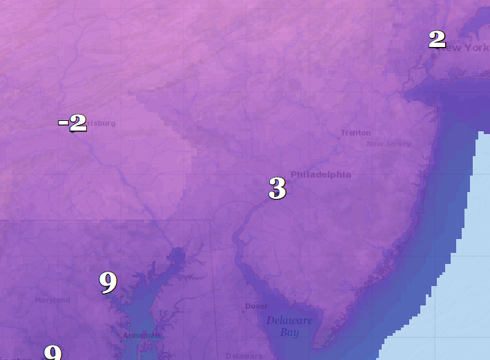
A forecast map showing low temperatures possible through Sunday night. (Credit: NWS) Click to Expand.
A dusting of snow – less than a half inch – could fall overnight between Thursday and Friday, the National Weather Service is forecasting. But after that, frigid temperatures will roll in, with the possibility of single-digit lows over the weekend.
The weak snow showers will likely come before 8 p.m. Thursday, forecasters said, but they will usher in gusty winds that could result in a wind chill factor of -5 degrees. Northwest winds overnight will blow 17 and 25 m.p.h. with gusts up to 40 m.p.h. On Friday, the high will only reach 21 degrees with an overnight low of 12, though it will be mostly sunny during the day.
The temperature rebounds a bit on Saturday, according to the NWS forecast, with a projected high of 37 degrees under cloudy skies. There is another chance of a dusting of snow, less than a half inch, on Saturday as well.
|
|
The low overnight between Saturday and Sunday will drop to 11 degrees and barely recovery Sunday, when the mercury won’t rise above 18 degrees, forecasters say. The overnight low Sunday night into Monday will drop as low as 3 degrees and rebound to just 22 degrees for Monday’s high temperature.
The good news: except for some flurries here or there, no significant snow is forecast over the next several days. The cold spell will likely break Tuesday, when the high will be 35 degrees and a wintry mix is possible.


