National Weather Service issued a winter weather advisory for midnight to 1 p.m. April 2.
Wet snow and sleet were forecast through 1 p.m. today, April 2, with a storm that may dump about an inch onto the area before quickly melting this afternoon.
While the National Weather Service’s winter weather advisory predicted a troublesome morning commute, it also said rising temperatures through the day would mean melting off of any accumulation in what would be a snowy/sleet/rain mix.
The advisory update, made 9 p.m. April 1, includes some advice on the commute, with the NWS advising: Plan on travel delays for the morning commute with poor visibility of one-half mile or less at times in bursts of heavier snow. “Road conditions will be highly dependent on precipitation rates as snowfall rates greater than 1 inch per hour and steadier sleet could allow for a slushy accumulation on untreated secondary roads. High temperatures Monday afternoon in the 40s will lead to rapid melting.”
|
|
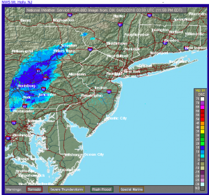
As to the forecast itself: “Rain will overspread the area between 2 and 5 a.m., then transition to a mix of sleet and wet snow from west to east between 5 and 8 a.m. The snow will be moderate to heavy at times with snowfall rates of up to 1 inch per hour possible briefly between about 6 and 9 a.m. The snow tapers off from west to east between 9 and 11 a.m. Monday morning.”
The week ahead sees highs forecast in the 60s, with other days in the 30s, for another stretch of fluctuating temperatures for the third week of spring. Wednesday’s forecast includes the high in the low 60s with a possible thunderstorm.
From the NWS:
A chance of rain between 2am and 5am, then rain and snow likely. Mostly cloudy, with a low around 35. North wind 5 to 11 mph becoming northeast after midnight. Chance of precipitation is 60%. Total nighttime snow accumulation of less than a half inch possible.
Monday: Rain and snow, becoming all rain after 11am, then gradually ending. High near 43. North wind 9 to 14 mph. Chance of precipitation is 90%. New snow accumulation of around an inch possible.
Monday Night: A chance of rain after 2am. Mostly cloudy, with a low around 37. South wind 3 to 6 mph. Chance of precipitation is 30%.
Tuesday: Rain likely, mainly after 8am. Cloudy, with a high near 53. Southeast wind 7 to 11 mph. Chance of precipitation is 70%. New precipitation amounts between a tenth and quarter of an inch possible.
Tuesday Night: Mostly cloudy, with a low around 51. South wind 11 to 17 mph.
Wednesday: Showers likely, then showers and possibly a thunderstorm after 11am. High near 61. Chance of precipitation is 80%. New rainfall amounts between a tenth and quarter of an inch, except higher amounts possible in thunderstorms.
Wednesday Night: Showers before 8pm. Low around 33. Chance of precipitation is 80%.
Thursday: Sunny, with a high near 48.
Thursday Night: Partly cloudy, with a low around 35.


