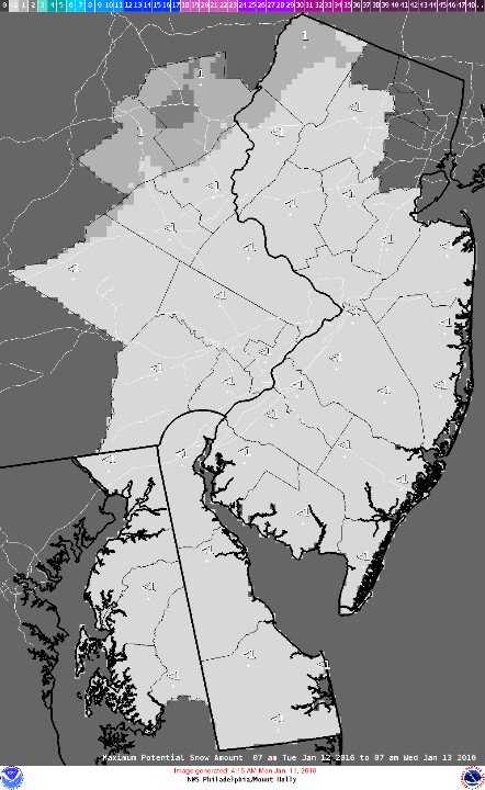
Snow lovers, you’re still out of luck.
Meteorologist Gary Szatkowski of the National Weather Service office in Mount Holly said Tuesday that the “worst case scenario” for a potential snow shower Tuesday night is an accumulation of less than an inch. Only a tiny sliver of far northwestern New Jersey could get more – and there it will not accumulate more than one inch.
Clouds will increase Tuesday before some rain showers move in after 12 noon, the current forecast from the NWS says. Then, a chance of rain and snow showers before 7 p.m., followed by a chance of snow showers between 7 p.m. and midnight. Skies will clear by Wednesday morning, with temperatures hovering near freezing.
|
|
Szatkowski said forecast models are remaining “on again, off again” about a potentially larger storm next Sunday into Monday. It is still too early to tell whether the storm, if it develops, would bring rain or snow to the Shore area.


