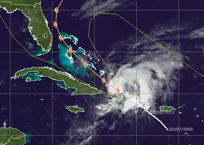
It is thousands of miles away, but forecasters are already warning that a hurricane which has the potential to brush Florida and the Outer Banks of North Carolina over the next several days could find itself off the coast of New Jersey early next week.
Forecast models are notoriously inconsistent this far out, but nearly all plots bring the storm up the U.S. east coast after brushing the east coast of Florida. The point of divergence for the models is how close, exactly, the storm will hug the coast. For New Jersey, the effects of the storm could be felt Tuesday, though the storm is forecast to be moving quickly by then, sparing the Shore from an extended period of potentially heavy rain and strong winds. The current forecast shows the storm maintaining hurricane strength as it brushes the Outer Banks at 8 p.m. Monday, but weakening to the subtropical storm Tuesday at 8 p.m. off the coast of New England. It is the time within those two points when New Jersey would be affected.
Longer-range (120+ hours), the ECMWF has Isaias riding up the eastern seaboard and into New England. This would bring heavy rains and strong winds along the I-95 corridor. Confidence remains too low at this point to have much confidence, but the signal is certainly there. pic.twitter.com/SuXlyfecFg
— WeatherOptics (@weatheroptics) July 30, 2020
|
|
“Regarding astronomical tides, we will be coming off the Full Moon on Monday August 3rd,” meteorologist Gary Szatkowski said in a tweet on his popular weather page. “Folks at the Shore know that tides will be running a little higher because of that. We will only need about one foot of surge to reach minor coastal flooding as Isaias passes by.”
The European model, considered one of the most reliable for long-term hurricane tracking, forecasts the storm will remain close to the coast, but many others predict it will jut eastward offshore, sparing New Jersey. The official track from the National Weather Service, as of this writing of this article Friday morning, brings the storm farther offshore than the EURO model.
Regarding astronomical tides, we will be coming off the Full Moon on Monday August 3rd. Folks at the Shore know that tides will be running a little higher because of that. We will only need about one foot of surge to reach minor coastal flooding as #Isaias passes by.
— Gary Szatkowski (@GarySzatkowski) July 30, 2020
“There remains a fair amount of uncertainty as we get into the early part of next week,” the National Weather Service office in Mount Holly said in a social media post.
Currently, tropical storm watches on in place on Florida’s east coast. The storm has already caused flooding and power outages in Puerto Rico.

Advertisement

Police, Fire & Courts
Grand Jury Indicts Point Pleasant Man, Once a Fugitive, for Attempted Murder


