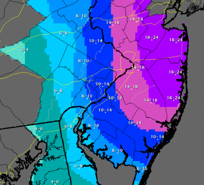
Snow totals, updated 4 p.m. Monday, Jan. 26. (Click to Enlarge)
As a blizzard warning remained in effect, the National Weather Service said that Brick – and the vast majority of Ocean County – would receive between 18 and 24 inches of snow between Monday evening and Tuesday.
At one point, forecasters had predicted as much as 30 inches or more could fall in the local area, and some meteorologists have stuck to that prediction. Forecasters have been pulled in varying directions by different forecast models; the European model shows the area will receive more snow than two North American models, though all shows the storm dumping a significant amount of snow on Ocean County.
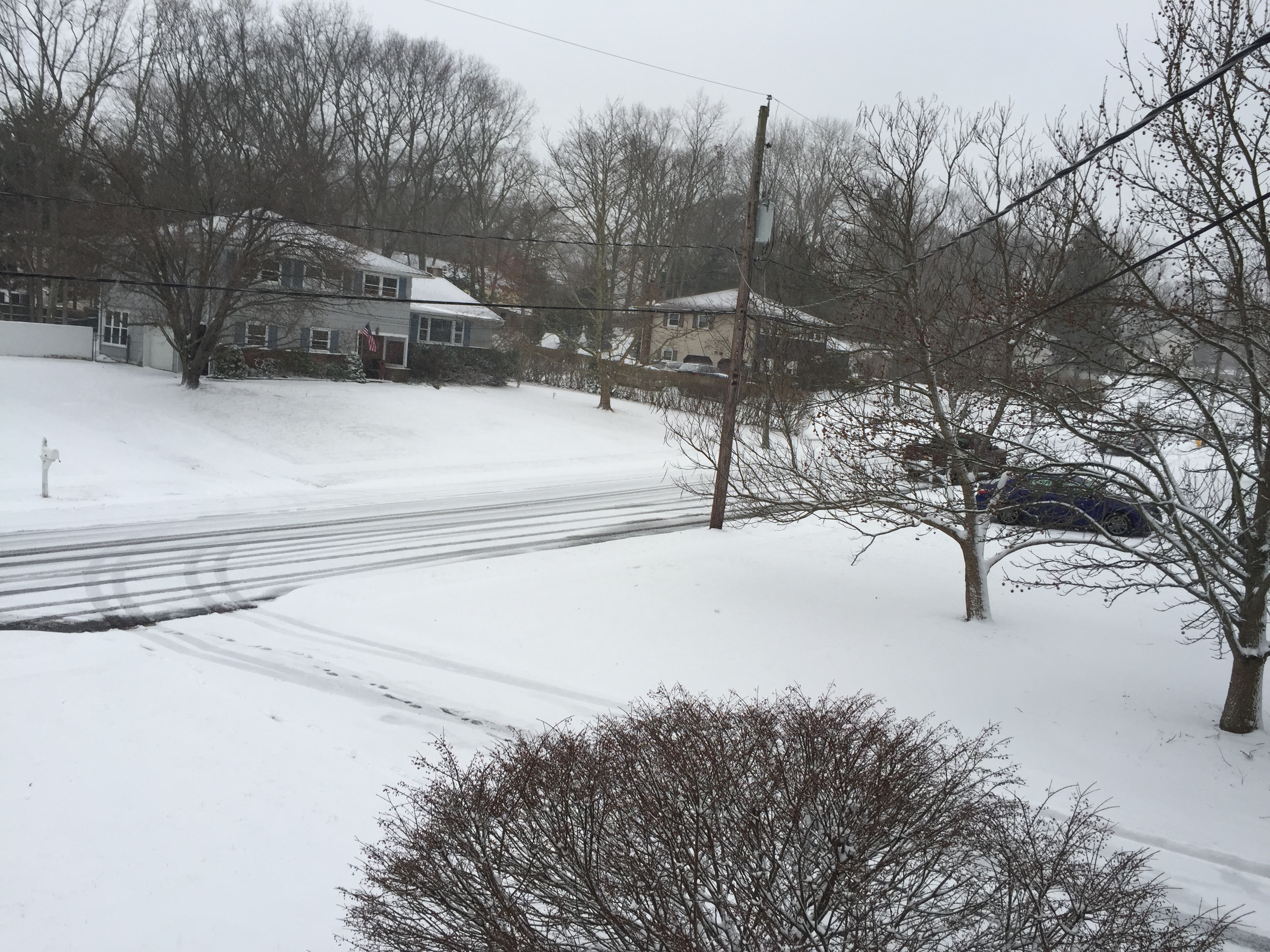
Snow covering a Brick Township street just after 4 p.m. Monday, Jan. 26, 2015. (Photo: Daniel Nee)
|
|
The 18-24 inch zone has been moved southward to encompass nearly all of Ocean County. Previously, just northern Ocean County was included in that forecast zone. But even as the National Weather Service issued its 4 p.m. snow total predictions, forecasters conceded they could shift in either direction as the storm develops offshore.
“Small shifts with the track and intensity of the system can still change these forecasted totals as the evening goes on,” a statement from the National Weather Service’s Mount Holly office said.
Snow will become steadier over the evening hours, a briefing from the office said, with the brunt of the storm occurring from late in the evening on Monday night through midday Tuesday. Snowfall rates during those hours could be between two and four inches per hour, the statement said. Northeast winds will be sustained between 20 and 30 m.p.h. with gusts to 50 m.p.h. possible. Temperatures will remain in the mid-to-upper 20s.
A coastal flood warning was also in effect from 11 p.m. Monday to 7 a.m. Tuesday. Ocean tides could run as much as seven feet above normal while back bay tides could run between three and four feet above normal.


Police, Fire & Courts
Teacher From Brick, 36, Charged With Carrying on Affair With Student

Brick Life
Adult Autism Transition
Police, Fire & Courts
Teacher From Brick Charged in Another Sex Affair With Student


