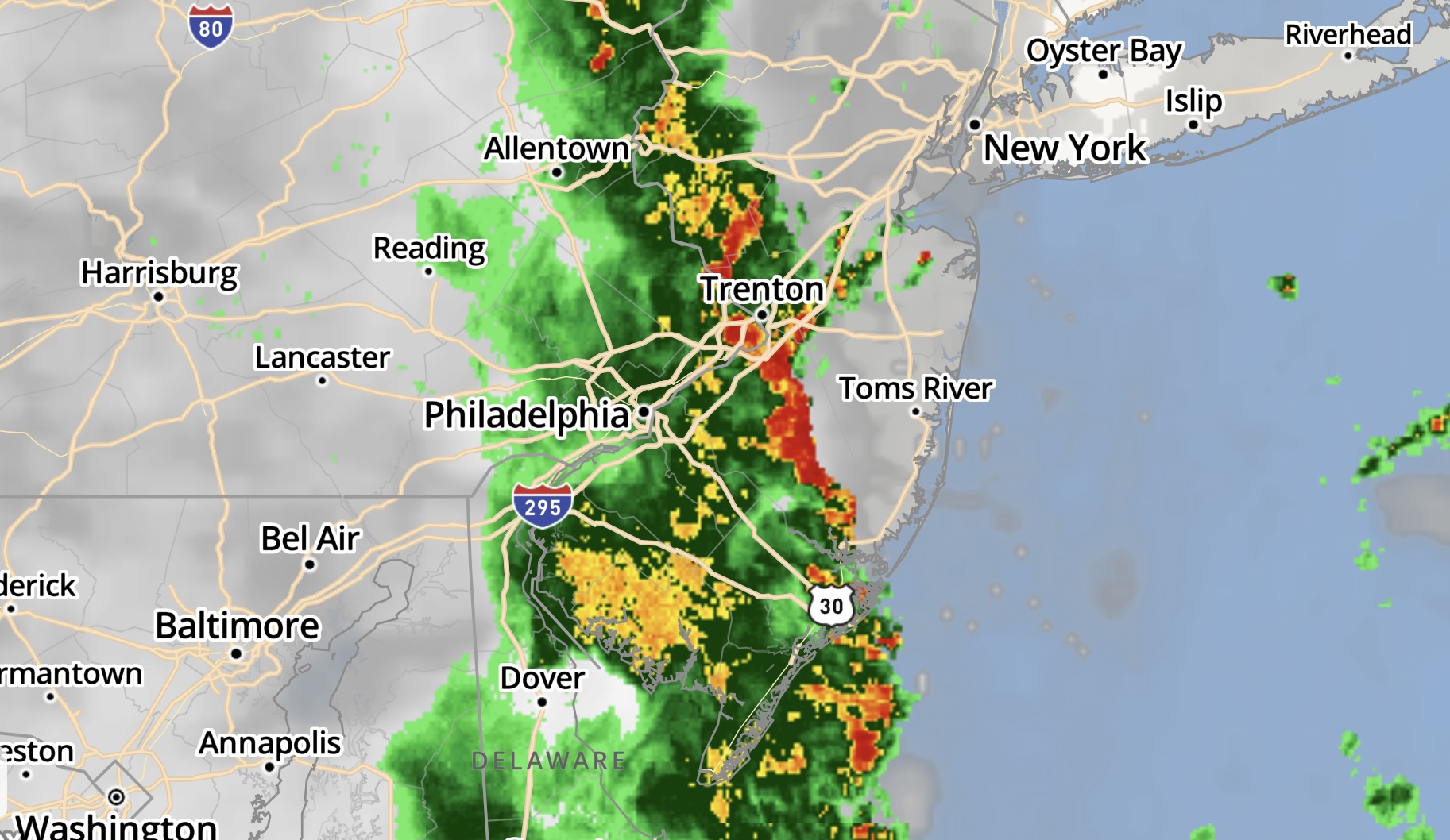
A line of storms moving into the region, 4:07 p.m., May 27, 2022. (NWS Radar)
The National Weather Service has issued a severe thunderstorm warning until 4:30 p.m. for the Ocean County area, with a severe thunderstorms watch in place until 7 p.m. Tornado watches and warnings have not been issued for the immediate area, however several have been issued to the west of the region.
Severe Thunderstorm Warning including Lakewood NJ, Browns Mills NJ and Pine Lake Park NJ until 4:30 PM EDT pic.twitter.com/0WQPosKuRt
— NWS Mount Holly (@NWS_MountHolly) May 27, 2022
A severe thunderstorm was located over Penn State Forest, or 23 miles north of Atlantic City, moving northeast at 45 mph, as shown in the radar image embedded with this story. According to the NWS warning, the storm contains 60 m.p.h. winds and penny-size hail. Damage to roofs, siding, trees, and power lines is possible.
|
|
A special marine warning was also in effect.
Special Marine Warning including the Coastal waters from Manasquan Inlet to Little Egg Inlet NJ out 20 nm, Waters from Great Egg Inlet NJ to Cape May NJ out 20 to 40 nm and Coastal waters from Great Egg Inlet to Cape May NJ out 20 nm until 4:30 PM EDT pic.twitter.com/3w431BAMvT
— NWS Mount Holly (@NWS_MountHolly) May 27, 2022


Police, Fire & Courts
Teacher From Brick, 36, Charged With Carrying on Affair With Student

Brick Life
Adult Autism Transition
Police, Fire & Courts
Teacher From Brick Charged in Another Sex Affair With Student


